
Circumnavigation of Vinalhaven, 6.12.15 - 6.14.15
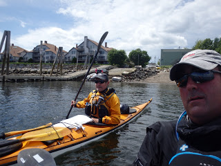 |
| Tim and I |
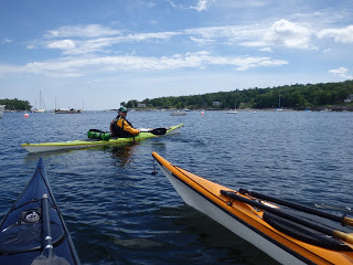 |
| Jon |
 |
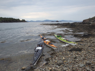
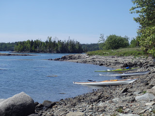
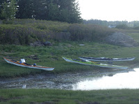
| Pocket beach on Mark Island at low tide |

After a stop at Pulpit, we headed along the shore to Oak Island, taking in the view of some spectacular homes on North Vinalhaven.
We had planned to use Oak Island as a base camp for the entire weekend, but the small group of easy going paddlers and calm weather conditions enticed us to alter our plans and circumvent Vinalhaven. After exploring the island and having dinner, the decision was made to bunker down in the one-room cabin, we could see the approach of the forecasted rains. This decision turned out to be the best one of the trip, as the skies opened up that night with reports the next day of more than 1 inch of rain in the surrounding hills.
 |
| Crossing from Mark to North Vinalhaven |
 |
| Approach to Pulpit Harbor |
 |
| Taking a break in Pulpit Harbor |
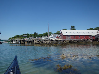
DAY 2: On Saturday, we packed up the boats once again and began the trek towards Vinalhaven. The group decided to leave the eventual campsite decision to later in the day given the options of camping on one of several MITA islands in the area. Following the coast, we paddled towards North Vinalhaven, stopping at Indian Point before stopping once more in North Vinalhaven for lunch. We turned a few heads in our drysuits but had an enjoyable meal at the local cafe before heading back to the boats.
90 minutes after high tide found us fighting our way into the Basin from the southern end. Entry may not be possible at 120 minutes past high tide. Once through, we came upon one of the more beautiful and undisturbed locations on the entire trip. After a quick rest stop, we located the northern entrance. Although the northern entrance has the potential for a lot of moving water, not much was happening when we finally arrived. It will deserve another visit. During our Surfside breakfast, one local told us that the rapids there almost sank a lobster boat.
 |
| Rest stop in Mullen Cove |
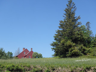 |
| House on Mullen Cove |
 |
| Approaching North Vinalhaven |
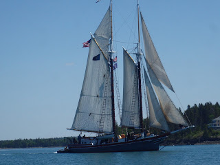 |
| Schooner in Fox Thoroughfare |
We set off from North Vinalhaven to check out the first two potential MITA campsites. The first and preferred one had a not-so-happy-to-see-us Osprey, very noisy and agitated by our presence, with a nest right above the campsite. In the spirit of interspecies harmony, we felt we had enough in the tank to venture on to Vinalhaven, possibly having to commando camp or continue to the MITA campsite located a bit past Vinalhaven.
 |
| Boats ashore on Narrows Island |
 |
| View from Narrows Island |
 |
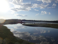
| Sunset on approach to Vinalhaven (Carver's Harbor) |
After 20nm, and few choices to camp, we decided to land at the boat ramp in Vinalhaven at the end of Carver's Harbor to assess the situation. As we approached the boat ramp, two people were out on a balcony sipping wine. I jokingly asked if they knew anywhere to camp, and they responded, gesturing to their building, "Why not here?", It turned out that the place was a motel, right next to the boat ramp. After Jon had inquired about availability, it turned out they had one room with three beds and were happy to have us. So, once again, the tents would not be set up. Instead, after searching high and low for a place to eat open after 9 pm, we ended up at Salt, a very good, if not very pricey, restaurant. Good gnocchi, beer and ceviche, though!
DAY 3: On Sunday, we ended up at the Surfside Diner, a local spot you would never find without the help of a local. After a breakfast of eggs over easy, fishcakes and toast, along with interesting conversations with some off the locals, we repacked our boats and headed off on the final 17 nm of the trip. The weather was once again uneventful, so we paddled toward the Basin Preserve, with the expectation of getting into some current.
 |
| Looking back at southern entrance to the Basin |
 |
| Looking out over the Basin to the north |
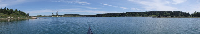 |
| Panoramic shot of the Basin |
With no current, we pressed on and located the last MITA island in the area before heading for Stand-in Point. From there we made our way back to Mark Island, now with the appropriate ferry angle, ending up back in Camden around 6 pm on Sunday. 50 nautical miles over three days, complete with exquisite company and breathtaking views of the natural beauty that is Vinalhaven, can't be beaten. We will be back.
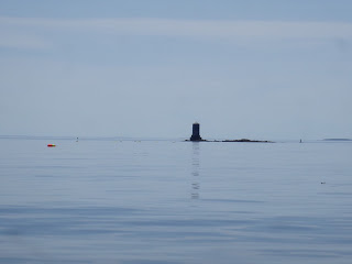 |
| Daymarker on Drunkard Ledge |
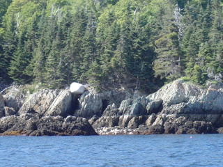 |
| Possible erratic on southern side of Mark Island |
 |
| RN4 on return to Camden |
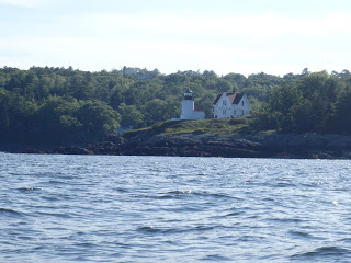 |
| Curtis Point Light, Camden |